Terrain properties are the base z-height above sea level, ground thickness, default materials for ground surface and sections, and drawing a point mesh in the 2D drawing. You can open the terrain properties for editing in the following ways:
Base z-height above sea level
If the project has ABOVE_SEA_LEVEL parameter, the field contains its value as a default. If necessary, enter a new value in the text field. Set the base height of the future building as the base height. If you do not know the base height, you can use the value 0.
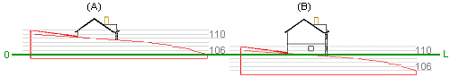
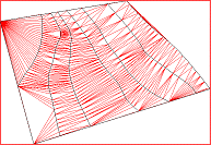
The terrain's base height is always placed at the zero level of the drawing-model pair. In the figure below (A), the terrain was initially modeled so that the base height (L) is 106 m. In figure (B), the terrain's base height (L) was changed into 110 m.
Thickness of ground
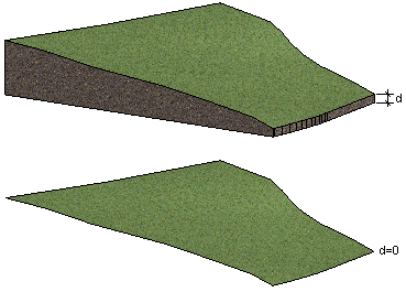
The thickness of the modeled ground layer (d) at the lowest terrain point. If the value is 0, the terrain consists of just the surface in the model.
Material to ground
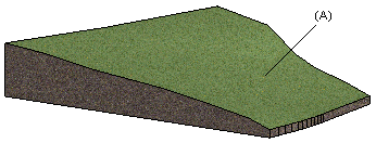
Select the material (A) of the ground surface, used in OpenGL shading and model visualization, from the list. The list contains a number of pre-selected LightWorks materials. You can select any LightWorks material by selecting the final option on the list, More. Select the material from the browser.
Material to section
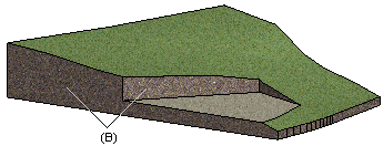
Select the material for the ground section (B), used in OpenGL shading and model visualization, from the list. The list contains a number of pre-selected LightWorks materials. You can select any LightWorks material by selecting the final option on the list, More. Select the material from the browser.
Draw mesh of points in 2D
When this checkbox is selected, the program will draw the terrain as a mesh of points in the 2D drawing. If necessary, you can disable the mesh of points by clearing the checkbox.
![]() Adding a
Terrain
Adding a
Terrain
![]() Editing Points
Editing Points
![]() Editing Properties
Editing Properties
| Converted from CHM to HTML with chm2web Pro 2.85 (unicode) |